5 Acres Near Petrified Forest
Saint Johns, AZ 85936
Apache County, Arizona
Farm Description
5 Acres Near Petrified Forest - Secluded Off-Grid Escape | Borders State Land
________________________________________
The Opportunity
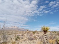
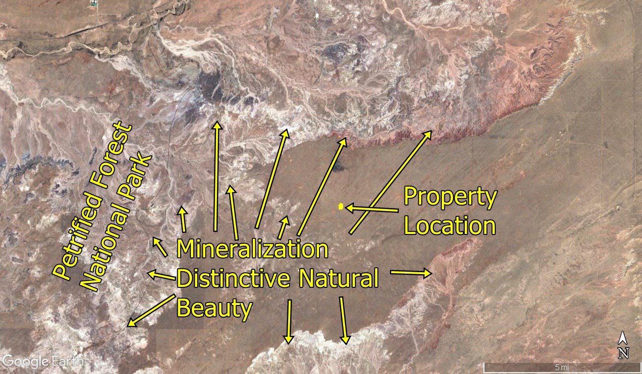
Own 5 acres in a truly remote, secluded area of Apache County, Arizona - approximately 3 miles east of Petrified Forest National Park.
If you're looking to get away from people, noise, and restrictions… this is it.
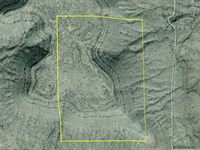
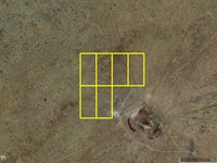
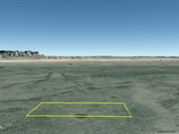
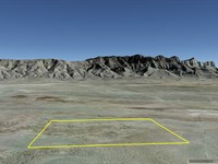
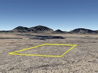
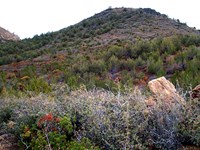
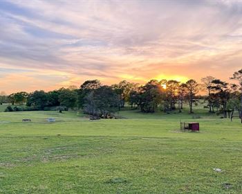
This property sits in the Puerco Ridge / Black Knoll area, surrounded by wide open desert beauty, colorful terrain, and big skies. The north side borders state-owned land, giving you extra privacy and a buffer from future neighbors.
This is ideal for:
• Off-grid homesteaders
• Weekend escape / camping property
• Long-term land investment
• Buyers who value solitude and independence
________________________________________
Location
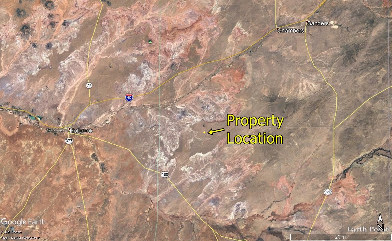
• 26 miles east of Holbrook
• 1 mile south of Black Knoll
• Remote access via trail roads (Suv or pickup required)
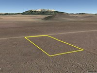
Approximate GPS Coordinates (corners):
• Nw: 34.894521, -109.688436
• Ne: 34.894508, -109.687344
• Se: 34.892683, -109.687376
• Sw: 34.892693, -109.688476
Located in a quiet, elevated desert area with open views, volcanic features, and colorful badlands terrain similar to nearby national park land.
________________________________________
Access
• Legal access (not landlocked)
• 30 ft easement along north boundary
• Section line trail road less than 400 ft away
• Old trail road runs through property
• Buyer may improve/grade access if desired
Note: This is rugged terrain - a truck or SUV is required
________________________________________
Property Highlights
• Borders state land (added privacy)
• No HOA / No Poa
• No subdivision restrictions
• Zoned Agricultural
• Build if and when you want to
• Unrestricted camping allowed
• Tiny homes welcome - - Apache County has a building code for them
• Extremely quiet and secluded
________________________________________
Utilities
• Off-grid (no utilities)
• Excellent solar potential (Arizona sunshine)
________________________________________
Area & Recreation
You're surrounded by unique Southwest landscapes. These attractions are nearby:
• Apache-Sitgreaves National Forest
• Canyon de Chelly National Monument
• Lyman Lake State Park
• Sunrise Ski Resort
Hiking, exploring, hunting, and off-grid recreation opportunities are everywhere.
________________________________________
Pricing & Financing
$294 down gets you started
Owner Financing Available:
• $294 initial payment ($99 down + $195 doc fee)
• As low as $123.94/Month for 6 years
• No banks
• No credit checks
• Everyone qualifies
Cash Purchase:
• 10% discount available for paying in full
________________________________________
Important Notes
• No utilities - off-grid only
• Remote access - not suitable for standard passenger cars
• No business/commercial use allowed while under financing
• Buyer must perform their own due diligence
________________________________________
Why This Property?
Properties this close to Petrified Forest National Park, with state land bordering, and this level of seclusion are getting harder to find - especially at this price point.
If you've been looking for a place to:
• Disconnect
• Build a rugged homestead
• Or simply own a piece of Arizona land far from everything…
This is worth your serious consideration.
________________________________________
Next
To purchase or for more information, please click on the green Land Website button below.
Farm Maps & Attachments
Directions to Farm
From Holbrook go east on I-40 for about 38.3 miles.
Take Exit 325 toward Navajo.
Continue onto Navajo Rd and 0.3 miles after exiting turn right onto Kerr McGee Rd.
0.4 mile later continue onto F Rte 2015.
3.5 miles later turn right to stay on Rte 2015.
2.4 miles later continue onto Rte 2007.
4.7 miles later continue onto Rte 7230.
0.4 mile later at 34.958672 -109.524347 the road bends toward the south and becomes Rte 2007.
1.1 miles later continue west onto Spurlock Side Rd W.
0.2 mile later at 34.951608 -109.540575 do not follow the main road as it bends to the left, instead turn right and immediately go west on Spurlock Side Rd W.
3.4 miles later at 34.924042 -109.573622 turn right going west on County Rd 7002.
6.33 miles later at 34.918658 -109.682847 turn left.
0.92 mile later at 34.909231 -109.685306 turn left.
0.98 mile later at 34.895169-109.685439 turn right heading roughly southwest.
0.13 mile later you will be at the property.
More Farm Details
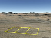
More Farms from Samantha Stephens
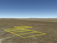
 26.6 AC : $20K
- 7.5 AC : $12K
-
25.1 AC : $18K
- 11 AC : $24K
- 20.2 AC : $15K
- 9.4 AC : $25K
- 7.5 AC : $12K
- 10 AC : $30K
- 10 AC : $16K
- 7.5 AC : $34.8K
- 5 AC : $30K
- 20.9 AC : $20K

