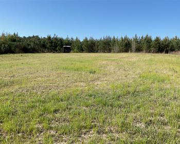
Memorial Day Land Sale, 7.5 Acres
Sanders, AZ 86029
Navajo County, Arizona

Farm Description
Memorial Day Special
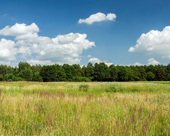
Some of the best memories start with family, good food, a campfire, and a place everyone looks forward to coming back to.
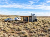
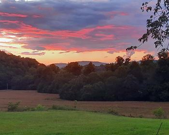
This Memorial Day, imagine gathering on your own 7.5 acres near Holbrook, Arizona - grilling outside, watching the kids explore, sharing stories around the fire, and ending the night under clear Arizona skies filled with stars.
Bring the RV, invite family and friends, and enjoy a property where future traditions can grow year after year.
Spend your days exploring nearby attractions like:
Meteor Crater
Painted Desert
Petrified Forest National Park
While still being close to:
Maintained road access
Nearby gas stations & convenience stores
Restaurants and shopping in Holbrook
Whether it's holiday weekends, family camping trips, or peaceful desert sunsets together, this property gives you the space to slow down and enjoy the moments that matter most.
Limited Memorial Day Deal
$100 Down - Was $300
$150 Doc Fee - Was $250
A beautiful Arizona property where future family memories and traditions can begin.
APN: 105-60-056 (North Parcel)
Acreage: 2.5 Acres
State: Arizona
County: Navajo County
Location: Sun Valley, Navajo County, AZ 86029
Legal Description: Rancho 99 Lot 56
Conveyance: Warranty Deed
APN: 105-60-057 (Middle Parcel)
Acreage: 2.5 Acres
State: Arizona
County: Navajo County
Location: Sun Valley, Navajo County, AZ 86029
Legal Description: Rancho 99 Lot 57
Conveyance: Warranty Deed
APN: 105-60-084 (South Parcel)
Acreage: 2.5 Acres
State: Arizona
County: Navajo County
Location: Sun Valley, Navajo County, AZ 86029
Legal Description: Rancho 99 Lot 84
Conveyance: Warranty Deed
Road Access: Dirt Road
Terrain: Flat, Plain, Desert
Closest Highway: State Hwy-77, I-40
Elevation: 5,518.37 ft
Property Location(S):
APN: 105-60-056 (North Parcel)
GPS Coordinates Center: 35.066650, -110.022050
Google Map Link:
APN: 105-60-057 (Middle Parcel)
GPS Coordinates Center: 35.065787, -110.022074
Google Map Link:
APN: 105-60-084 (South Parcel)
GPS Coordinates Center: 35.064800, -110.022100
Google Map Link:
Annual Property Taxes: $14.40
No Credit/Bank Checks • No hidden fees • Low Annual Property Taxes.
Message us “Land22” for additional details