Large Ranch Backing Up To Blm Land
Abiquiu, NM 87510
Rio Arriba County, New Mexico
Farm Description
Owner Financing Available: 20% Down Payment of $5,000, 9.9% Interest Rate, $400 Monthly Payment, 60 Month Term
Location & Size
The subject property is a sprawling 25 acre ranch located in El Rito Estates, a rural residential subdivision situated just east of State Road 556 and a few short miles from Lake Abiquiu.
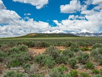
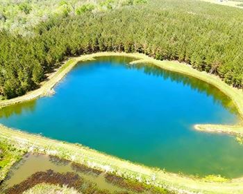
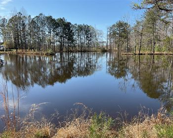
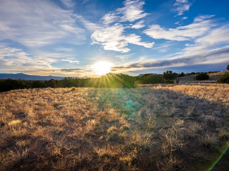
Flanked by stunning views of the Cerro Pedernal and the Sierra Negra, this region is perfect for the nature lover or outdoorsman in the family as it sits in close proximity of three lakes, a national forest and one of the premiere skiing destinations in the state. In addition, some of the best fly fishing in New Mexico can be found along the banks of the Rio Chama, conveniently located just a few miles outside the entrance to the subdivision.
County, State: Rio Arriba County, New Mexico
Lot Size: 25 Acres
Nearest Town: Abiquiu
Street Address: Not Designated
Zip Code: 87510
Latitude & Longitude:
Center: 36.23830,-106.14240
Nw: 36.2400,-106.14450
Ne: 36.23910,-106.14010
Sw: 36.23730,-106.14450
Se: 36.23730,-106.14010
Legal Information
Legal Description: El Rito Estates, Tract 157
Parcel Number: 1042137300240
Account Number: R010915
Annual Taxes: $190.00
Access & Utilities
Roads & Access: The subject property is located at the far eastern end of El Rito Estates, a subdivision which sits just east of State Road 556. There is one primary arterial within El Rito Estates which some maps identify as Fort Defina Road and other maps identify as El Rito Estates Road. It is this road which turns off the paved state road and will take you 95% of the way to the subject property.
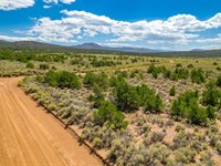
Roads & Access, Cont'd: It should be noted that Fort Defina Road becomes less maintained the further east you drive on it. It begins as graded gravel, transitions to graded dirt and gravel, eventually takes on a sandy consistency and then transitions into a two-track dirt road. Despite these less-than-ideal conditions, however, our photographer assures us it's better than it looks and can be navigated by any vehicle type. That said, we recommend anyone scouting the land for the first time take a larger truck or off-road capable vehicle.
Roads & Access, Cont'd: Because the subject property is located just north of Fort Defina Road, anyone scouting the property will need to drive until this road dead ends and then turn north along another road also identified as Fort Defina Road. Taking this road north and finally west will lead you along the northern boundary of the subject property. That said, due to the unmaintained nature of the roads (legal easements) it is advised that anyone scouting the property use a mapping app like Land ID to help focus their approach.
Power & Utilities: Residential power lines and underground utility boxes have a presence in El Rito Estates and appear to service some of the home sites closer to the western end of the subdivision. Those utilities, however, end two miles west of the subject property. In addition, many of the home sites closer to the subject property appear to be using solar panels as either a primary or secondary source of energy. Because of this, anyone looking to develop the land is encouraged to investigate alternatives such as the aforementioned solar panels. Anyone looking to investigate the cost of getting connected to the grid is encouraged to contact the Jemez Mountain Electric Co-op, the utility company servicing this region.
Wells & Water Table Depth: Along the same lines, there are some upscale home sites in this area which appear to have wells drilled on their properties, while some less expensive builds are using holding tanks. Prospective buyers looking to develop the land will need to consult local well drillers to learn more about the costs and logistics of drilling for water in this region to help determine which solution works best for their budget.
Legal Access: Yes
Access Road: Fort Defina Road
Access Condition: Unmaintained Dirt, Gravel and Sand
Access Frontage: Undefined
Power: Solar or Alternative
Phone: Mobile or Satellite
Water: By Well or Holding Tank
Sewer: By Septic or Alternative
Zoning & Restrictions
Zoning: Rio Arriba County has fairly undefined and lax zoning, and designates the El Rito Estates subdivision, as well as most of the land in the County, as "Crad" or County Residential Agricultural District. This catch-all term allows for land to be developed with either residential or agricultural purposes. Other uses, such as industrial and commercial developments, require a use permit obtained through a public hearing.
No HOA: The El Rito Estates subdivision features no HOA and there are no annual dues associated with land ownership here.
Covenants, Conditions & Restrictions: In addition to having no HOA, El Rito Estates has no covenants, conditions or restrictions (Ccrs) recorded with the County. This means there are no subdivision restrictions on land use either.
Camping & RV Use: Per Rio Arriba County Zoning, RVs are acceptable in this region for ninety days at a time or six months with a special use permit.
Zoning: Crad - County Rural Agricultural District
HOA: None
Covenants, Conditions & Restrictions: None
Annual Dues: None
Time Limit On Building: None
Title Info
Survey: The subject property has not been recently surveyed and there is no plat map on file with the County. That said, there are at least two dozen mapping apps that will confirm the exact size, shape, location and footprint of the land.
Anyone looking to purchase the property who would like to confirm the location, dimensions or boundaries of the property prior to taking title may request that the sale/purchase agreement with our Company be contingent on the commission of a new survey.
Due to the protracted nature of the average New Mexico property survey, however, Hemingway Land will request an additional $2,000.00 non-refundable earnest money deposit ($2,500 total) paid directly to our company before we will open escrow.
Additionally, once the survey has been completed, the Buyer will be responsible for the full cost of the survey which may be paid directly to the title company at close of escrow.
Title: Free & Clear
Liens and Encumbrances: None
Mineral Rights: None
Recent Survey: None
Title Insurance: None
Conveyance Document: Warranty Deed
Suggested Type Of Closing: Title/Escrow
Doc Prep Fee: Waived
Miscellaneous
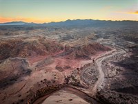
BLM Land: The subject property is bordered to its north by over 1,200 acres of BLM Land. The presence of such a feature has two benefits: First, it means the area to the north of you cannot be developed. This means the privacy and the views you purchase today will remain untouched for decades to come. Second, it means that you have even more land to hunt, hike, explore, shoot guns or ride dirt bikes on. In addition, the 1,200 acres of BLM land is flanked to its east and west by undeveloped County land and then Carson National Forest.
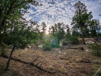
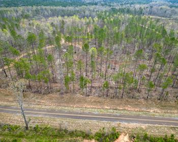
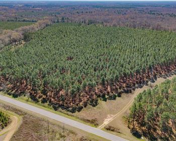
Topography: While mostly level, and boasting flat cut-out regions perfect for parking, camping or building, the subject property also has some rolling hills and is bisected by a sandy arroyo some maps identify as Las Langunitas. The terrain consists mostly of shrubland and pinyon-juniper.
Fencing & Boundary Markers: It should be noted that the subject property features a few boundary markers as well as a short run of fencing along its southern border (see photos in the gallery at the bottom of this page). Due to the sprawling nature of the parcel combined with its unusual shape, however, these markers are unlikely to help determine exact boundaries. Anyone looking to fence the property will need to commission a survey.
Hunting: It should be noted that the subject property is located in Game Management Unit 51, an area famous for its trophy bull elk.
Nearby Towns
Abiquiu: 12 miles (26 min)
Española: 27 miles (42 min)
Santa Fe: 52 miles (1 hr 10 min)
Taos: 66 miles (1 hr 25 min)
Albuquerque: 114 miles (2 hr 3 min)
Farmington: 164 miles (3 hr)
Nearby Attractions
Heron Lake State Park
El Vado Lake State Park
The Timbers At Chama
Fish Tail Ranch
Stone House Lodge
Navajo Dam Marina
Abiquiu Lake Recreation Area
Georgie O'Keefe Museum
Things To Do In Taos
Things To Do In Taos Ski Valley
Things To Do In Santa Fe