Tract 4 at Wolf Hill Estates
McArthur, OH 45651
Vinton County, Ohio
Farm Description
Tract 4 at Wolf Hill Estates
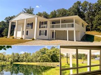
5 Ac Estate Home Site with Woods, Creek and Meadow
Wolf Hill Rd, Elk Twp, Vinton Co, Ohio
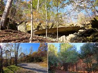
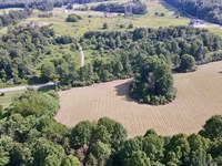
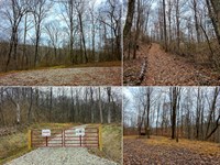
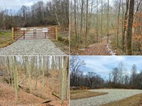
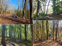
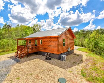
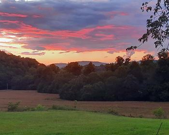
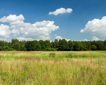
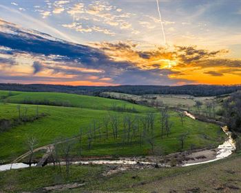
Imagine escaping to your own private sanctuary in the Hocking Hills region on this breathtaking 5.076 -acre partially wooded estate in Elk Twp, Vinton County, where the beauty of mature woods, rolling meadow and a gentle year-round creek create a serene, park-like retreat perfect for your family's dream home. With rolling hills that paint a picturesque backdrop and abundant wildlife that enchants nature lovers, this land offers a peaceful, remote country lifestyle, just minutes from town. Enjoy the freedom to design your forever home with the builder of your choice, no time constraints, and minimal deed restrictions, all while surrounded by the charm of Ohio's countryside.
Estate Home Site with a Nice Mix of Woods and Meadow
Choose your Own Builder - No Time Limit
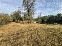
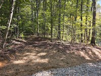
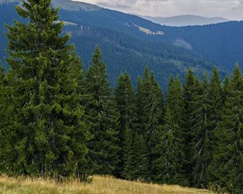
Beautiful Mix of Mature Woods and Meadow
Nice Seasonal Creek in the Woods
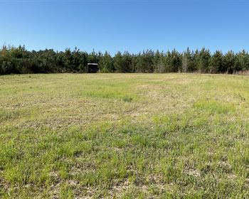
Gently Sloping Meadow, Well Suited for a Walk-Out Basement
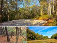
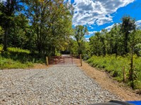
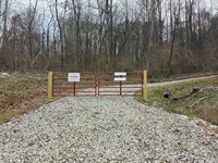
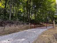
New Gravel Driveway with Paved Road Frontage, Entrance Shared with Tract 3
Picturesque Park-like Setting
Minutes from the Conveniences of Town (1.5 Miles to McArthur)
Endless Recreational Opportunities Both on Property and in the Area
Conveniently Located to Thousands of Acres of Public Recreation
2.7 Miles from Wellston Wildlife Area: Hiking, Boating, Fishing, Hunting, Etc
16 Miles to Ash Cave, Hocking Hills State Park
Beautiful Remote Country Setting
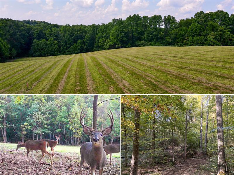
Loaded with Wildlife (Pics from Tract 8)
Excellent Deer and Turkey Hunting
5.076 Ac (New Survey) Tract 4 at Wolf Hill Estates
Additional Tracts Available
No Zoning and Minor Deed Restrictions
Mineral Rights Transfer, No Active Leases (Ato)
Buckeye Rural Electric Available
Area Water Wells Range From 360-400 ft Deep Producing 5-10 gpm
Elk Twp, Vinton County
Vinton County Local School District
Parcel 05-00275.006
Wolf Hill Estates is Located:
1.5 Miles to McArthur
8.5 Miles to Wellston
16 Miles to Jackson
17 Miles to Albany
28 Miles to Athens
28 Miles to Chillicothe
65 Miles to Columbus
0 Wolf Hill Rd, McArthur, Ohio 45651
Gps Coordinates : 39.235507, -82.508792
Wolf Hill Map
Maps and Additional Documentation
Locations Map.pdf
Park Areas Map.pdf
Survey.pdf
Topo Map.pdf
Wolf Hill Kml.Kml
Aerial Map.pdf
Covenants and Restrictions.pdf
Driveway declaration (Tracts 1-2).Pdf
Driveway declaration (Tracts 3-4).Pdf
Other Properties in Wolf Hill
Tract 1SoldTract 2SoldTract 3AvailableTract 4AvailableTract 5AvailableTract 6AvailableTract 7In ContractTract 8 HouseIn Contract
Property Location
? Map Options
Street Map
Satellite View
Hybrid View
Topographic Map
Countrytyme Properties Within 10 Miles
Property Images
Countrytyme Land Specialists3451 Cincinnati-Zanesville Road SW - Lancaster, OH 43130Call Us 1-Call Us Toll website uses cookies in compliance with Google Indexing, if you wish to opt out from tracking please call us and we will provide the information to you directly.
const galleryItems document.querySelectorAll('.gallery-item');
const lightbox document.getElementById('lightbox');
const lightboxImg document.getElementById('lightbox-img');
let currentIndex 0;
Galleryitems.Foreach(Item {
item.addEventListener('click', () {
currentIndex parseInt(item.getAttribute('data-index'));
lightboxImg.src item.getAttribute('data-full');
lightbox.classList.add('active');
function closeLightbox() {
lightbox.classList.remove('active');
function changeImage(direction) {
currentIndex + direction;
if (currentIndex galleryItems.length) currentIndex 0;
Lightboximg.Src galleryItems[currentIndex].getAttribute('data-full');
lightbox.addEventListener('click', (e) {
if (e.target lightbox) closeLightbox();
document.addEventListener('keydown', (e) {
if {
if (e.key 'Escape') closeLightbox();
if (e.key 'ArrowLeft') changeImage(-1);
if (e.key 'ArrowRight') changeImage(1);
// Initialize map with property coordinates
const propertyLat 39.235507;
Const propertyLng -82.508792;
// Map tile layers
const mapLayers {
street: L.tileLayer(' {
attribution: '© OpenStreetMap contributors',
maxZoom: 19
Satellite: L.tileLayer(' {
attribution: '© Esri',
maxZoom: 19
Hybrid: L.tileLayer(' {
attribution: '© Google',
maxZoom: 20
Topo: L.tileLayer(' {
attribution: '© Esri',
maxZoom: 19
// Define zoom levels for each map type
const mapZoomLevels {
street: 11, // Default street view
satellite: 17, // ~500 meters
hybrid: 17, // ~500 meters
topo: 17 // ~500 meters
// Initialize map with error handling
try {
const map L.map('propertyMap', {
center: [propertyLat, propertyLng],
zoom: mapZoomLevels.street,
layers: [mapLayers.street],
zoomControl: true,
attributionControl: true
// Add marker for property location
const marker L.marker([propertyLat, propertyLng])
.addTo(map)
.bindPopup("Current PropertyTract 4 at Wolf Hill Estates", {
closeButton: true,
offset: L.point(0, -25),
Autopan: true,
autoPanPadding: [50, 50],
Classname: 'property-popup'
// Store nearby listing markers
let nearbyMarkers [];
// Function to change map type with error handling
function changeMapType(type) {
try {
// Remove all base layers
Object.values(mapLayers).forEach(layer {
if (map.hasLayer(layer)) {
map.removeLayer(layer);
// Clear any nearby property markers when changing map type
nearbyMarkers.forEach(marker map.removeLayer(marker));
nearbyMarkers [];
// Add selected base layer
map.addLayer(mapLayers[type]);
// Reset view to focus on main property
map.setView([propertyLat, propertyLng], mapZoomLevels[type] || mapZoomLevels.street);
// Update active button
document.querySelectorAll('.map-controls button').forEach(btn {
btn.classList.remove('active');
event.target.classList.add('active');
} catch (error) {
console.error('Error changing map type:', error);
// Function to show/hide nearby listings
function showNearbyListings(event) {
const button document.getElementById('nearbyButton');
// Clear any existing markers first
nearbyMarkers.forEach(marker map.removeLayer(marker));
nearbyMarkers [];
// Show nearby listings
button.textContent "Loading Properties...";
console.log("Fetching nearby listings...");
// Fetch nearby listings from the server
fetch('./get_nearby_listings.php?lat ' + propertyLat + '&lng ' + propertyLng + '&id ' + 1817 + '&radius 10')
.Then(Response {
console.log("Server response received:", response.status);
return response.json();
.then(data {
console.log("Found nearby listings:", data.length, data);
if (data.length 0) {
alert('No other properties found within 10 miles');
button.textContent "Find Properties Within 10 Miles";
return;
// Create markers for each nearby listing
data.forEach(listing {
const marker L.marker([listing.lat, listing.lng]).addTo(map);
// Configure popup options for better positioning
const popupOptions {
closeButton: true,
offset: L.point(0, -25), // Position popup closer to marker
autoPan: true, // Ensures popup is visible in viewport
autoPanPadding: [50, 50], // Padding when auto-panning
className: 'property-popup' // Custom class for styling
marker.bindPopup('
${listing.name}
${listing.price ? '$' + Number(listing.price).toLocaleString() : 'Price not available'}
${listing.acreage ? listing.acreage + ' acres' : ''}
${Listing.Status || ''}
View Property
', popupOptions);
nearbyMarkers.push(marker);
// Adjust map bounds to show all markers
const allMarkers [marker...nearbyMarkers];
const group L.featureGroup(allMarkers);
map.fitBounds(group.getBounds().pad(0.1));
button.textContent "Find Properties Within 10 Miles";
// Don't remove active class from this button
if (event) event.stopPropagation();
.catch(error {
console.error('Error fetching nearby listings:', error);
button.textContent "Find Properties Within 10 Miles";
alert('Unable to fetch nearby properties. Please try again later.');
} catch (error) {
console.error('Error initializing map:', error);
function toggleMapControls() {
const mapControls document.querySelector('.map-controls');
const hamburgerIcon document.querySelector('.hamburger-icon');
mapControls.classList.toggle('show');
if {
hamburgerIcon.textContent '?';
} else {
hamburgerIcon.textContent '?';
Function openFirstImage() {
if (galleryItems.length 0) {
currentIndex 0;
Lightboximg.Src galleryItems[0].getAttribute('data-full');
lightbox.classList.add('active');
function myFunction() {
var y '39.235507,-82.508792';
Window.Open(" + y , "_blank");
Gps: 39.235507, -82.508792
Farm Maps & Attachments
More Farm Details
Farm Price History
More Farms from Countrytyme Realty
 70 AC : $900K
- 8.8 AC : $115K
- 6 AC : $77.9K
- 6.3 AC : $69.9K
- 5 AC : $69.9K
- 21.5 AC : $270K
- 21.4 AC : $260K
- 8.3 AC : $84.9K
- 11.4 AC : $105K
- 5.5 AC : $67.9K
- 5 AC : $58.9K
- 6.8 AC : $64.9K